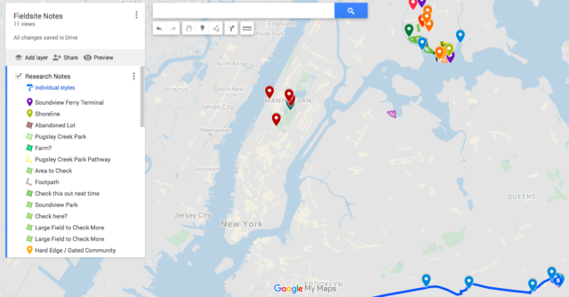
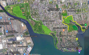
To adapt to my new research focus, the past few weeks I have set out to get to know potential fieldsites of coyotes moving into the boroughs of New York City. First, I used maps from Gotham Coyote Project to narrow down areas of potential coyote activity and cross-checked those with news and blog reports of coyote sightings. Next, I made assumptions about what parts of these locations coyotes might prefer based upon information of coyote behavior and ecology. Finally, I made plans to scout out the wider area to learn more about the surrounding natural spaces and communities.
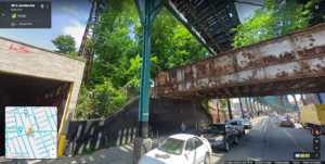
The pandemic has also changed how I travel to my fieldsites. To avoid the subway, I bicycled to all my fieldsites and had to take a ferry to the South Bronx. While I love biking, this was not always ideal: various parts of the city are not favorable to bicycling due to road conditions and fast-moving traffic, other areas were thick with fumes and sticky with heat, and navigating through new parts of the city was challenging (even with a smartphone). One morning before setting out, I wrote in my journal about these hesitations and my desire to hop on the train to make my journey shorter and faster. What I came to realize while writing my complaints out on paper was that these environmental pressures also impact coyotes and other animals that are on the move in our city. I added my commute notes to my fieldnotes as informal bisects of our city; recalling noise-levels, green areas that were pleasant to slow down and enjoy, and which areas were all pavement and traffic. The photo included here is of an abandoned railway that I noticed while biking that is the heart of an effort to create a highline-like project for Queens. For now, it may act as a convenient green pathway for animals to move through the city.
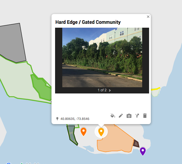
Once back home, I adapted fieldnotes, photos, and audio recordings into features on my project multimedia map. In addition to my observations, I used features of the landscape and surrounding areas as prompts for further research. For example, I’ve learned a lot about the history of the South Bronx, from the seasonal homes of the Indiegeous Wiechquaeskecks to 1920’s holiday bungalows, public housing and highway development projects, and more recent gated community and greenway project developments. My field visits bring me to places that speak of these histories—all it takes is staying curious and constantly asking “how did things get this way?”