I’m leaving for Kazakhstan in a few days and besides moving out of my apartment, I have spent most of my time mapping. In short, my project is interested in how humans create and interpret narratives of human lives, particularly in the context of prehistoric societies. I’m going to approach this topic through the use of visually intuitive maps.
I’ve spent these last few weeks working on breathing life into my Caveatron – a cave mapping device I assembled last semester. Although assembly was complete, I underestimated how much more troubleshooting would continue to be a part of my everyday life. I stumbled across issues and would tinker around for a bit until I finally tried something that fixed the problem. For instance, 2 major problems I was having were related to wiring. In short, some of the wires were not soldered super well and a couple connections were switched.
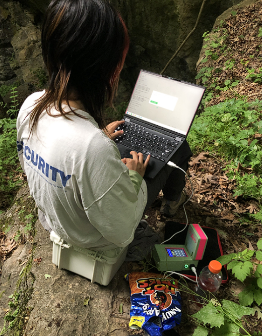
After figuring this out, I was ecstatic and started attempting to map everything. I mapped my room, I mapped building hallways, I mapped my friends’ dorms, and I mapped a climbing gym. After mapping a few of these places, I began calibrating the Caveatron – an essential part to making sure that the data is accurate. To spare you from the lengthy details, I drew dots on the wall, ceilings, and floors, and went to Governor’s Island and a park in Kingston to rotate the device in circles and take measurements at every 30 degrees in a full circle.
After all of that, I mapped out a climbing gym with a couple of friends after a late night climbing session where most other people had left. I placed tape with survey labels throughout the gym and began surveying.
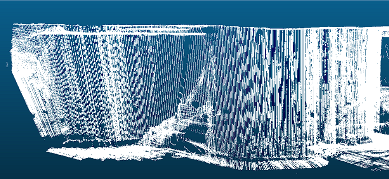
It’s not too pretty yet, but it’s something. I’m working on learning how to clean up the data and am finetuning the calibration. It is very sensitive, as expected, to anything with a magnetic field, making it non ideal for buildings. Well, fortunately I’m using it for caves.
After some more test maps, I did a more “official” test run in Sterling Mine with my professor Karen Holmberg. We met up with Doug, a worker at the museum that now leads tours through the mine, who was very passionate about the mine and used to be a miner before it closed. I really enjoyed getting to know him and the mine! It was so fascinating to see all the fluorescent minerals and hear about his relationship with the mine and surveying. We shared the same excitement about surveying as I learned that he was a surveyor for 3 years prior to being a miner. Him and Karen switched off holding the reflective survey sheet as we went through the mine.

I’m looking forward to cleaning up my calibration before Kazakhstan and getting to map in the field!